Home › Routes › Motorhome routes › Murcia coast
A route along the Costa Cálida in the Region of Murcia, in south-east Spain: from Águilas past Cabo Cope and Puntas de Calnegre to Bolnuevo and Puerto de Mazarrón, then on to Cartagena and Cabo de Palos. It continues our Almería coast route, which ends at Vera, about 30 km south-west of Águilas. Here is what you need to know before you go: stops, where you may stay overnight, the access rules for the Calblanque regional park, Spain’s parking rule for motorhomes, and how to find campsites and motorhome stops on the AlpRoute map.
| Start and end | Águilas to Cabo de Palos, Region of Murcia |
| Distance | About 134 km by road, including the side trips to Cabo Cope, Puntas de Calnegre and Bolnuevo; about three hours of driving without stops (our calculation from OpenStreetMap data) |
| Days | Three, with visits on the way (our suggestion) |
| Best time | Autumn to spring (our suggestion). Turespaña says the coastal towns of the region get more than 3,000 hours of sunshine a year [1] |
| Our rating | Easy to moderate: mostly regional roads. Between Cabo Cope and Mazarrón the route uses smaller local roads with bends, and the side trips to Cabo Cope, Puntas de Calnegre and Bolnuevo are out-and-back drives on the same road (our assessment from map data) |
| Regional park | Near Cabo de Palos, the Calblanque regional park restricts motor vehicles in its beach area at certain times [3] |
| Overnight | Plan each night at a campsite. Three campsites on this route are listed as open all year [2] |
| Parking rule | Since 1 October 2026, a motorhome parked on a public road in Spain must not have anything sticking out beyond its outline, must rest only on its wheels and must not release fluids from the living area [4] |
Short daily distances. Campsites open all year on the route [2].
We found no general restriction for this route in the official sources we checked. Follow local signs.
Motor vehicles are not allowed in the beach area of the park from 20:30 to 08:00 all year, and in summer, access is also restricted during the day [3].
The day stages are our suggestion. The route follows regional roads along the coast and avoids city centres where it can.
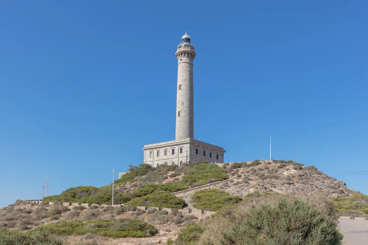
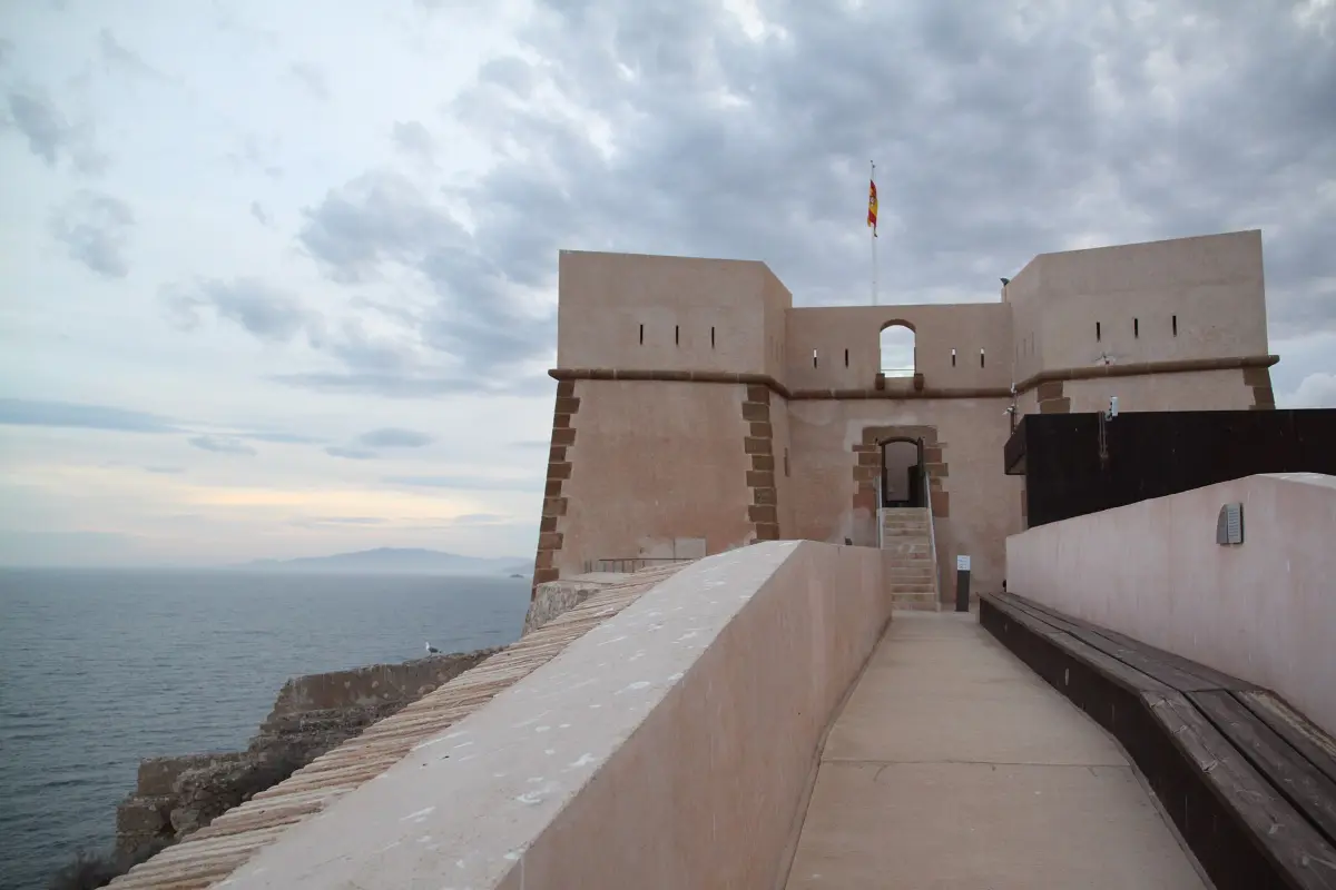
In Águilas, Turespaña recommends the views from the Hornillo viewpoint and the Castillo de San Juan de las Águilas, the town beach of Las Delicias, the Cuatro Calas coves and La Carolina beach [1]. The road then runs past Calabardina to Cabo Cope and on to the small coastal village of Puntas de Calnegre.
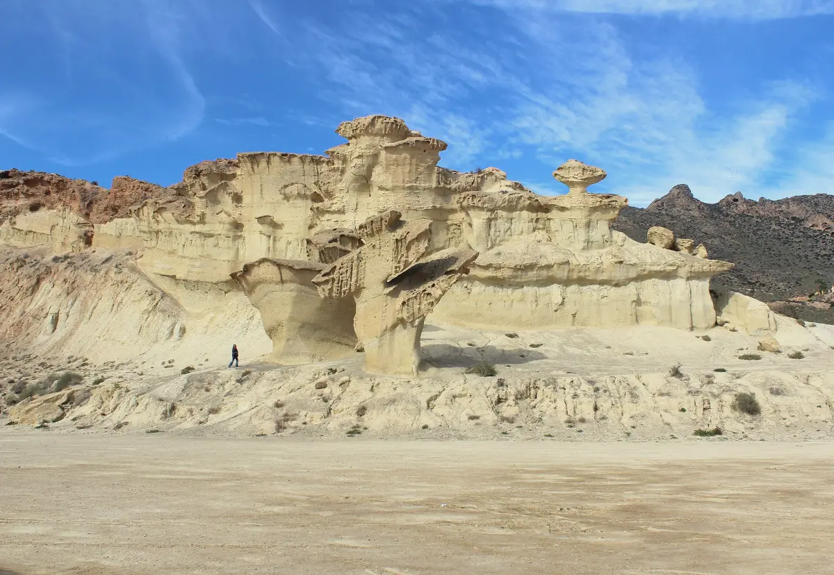
From Calnegre the route climbs inland and joins the RM-332 towards Mazarrón. At Bolnuevo there are sandstone formations shaped by wind and water. Turespaña also mentions 35 signposted walking and cycling routes in the Mazarrón area and the morning fish auction in Puerto de Mazarrón [1].
The RM-332 takes you to Cartagena, with the Roman Theatre Museum and the Museum of Underwater Archaeology. The municipality has more than 40 km of coast, including the Calblanque natural area [1]. The route ends at Cabo de Palos, a small peninsula about 400 m wide with coves of clear water and, according to Turespaña, one of the Mediterranean’s most important marine reserves [1]. If you want to visit the Calblanque beaches, check the access rules first [3].
We found no regional list of authorised motorhome areas for this coast in the official sources we checked, so we suggest campsites. The Region of Murcia’s campsite guide lists several coastal campsites as open all year [2].
| Start | Camping & Bungalows Bellavista, Ctra. de Vera km 3, Águilas. Listed in the regional campsite guide as open all year [2]. Its website did not load when we checked; contact the campsite before you go. |
| On the way | Camping Las Torres, CN-332 Mazarrón–Cartagena km 26, Puerto de Mazarrón. Open 365 days a year, with pitches of 70–90 m², according to its website [5]. The regional guide also lists Camping Playa de Mazarrón in Bolnuevo, and gives its low season as 1 January–30 June and 14 September–31 December [2]. |
| End | Camping Caravaning La Manga, Autovía Cartagena–La Manga exit 11, Playa Honda (Cartagena), on the Mar Menor, near the Calblanque regional park, with pitches of about 84–100 m² [6]. Listed as open all year in the regional guide [2]. |
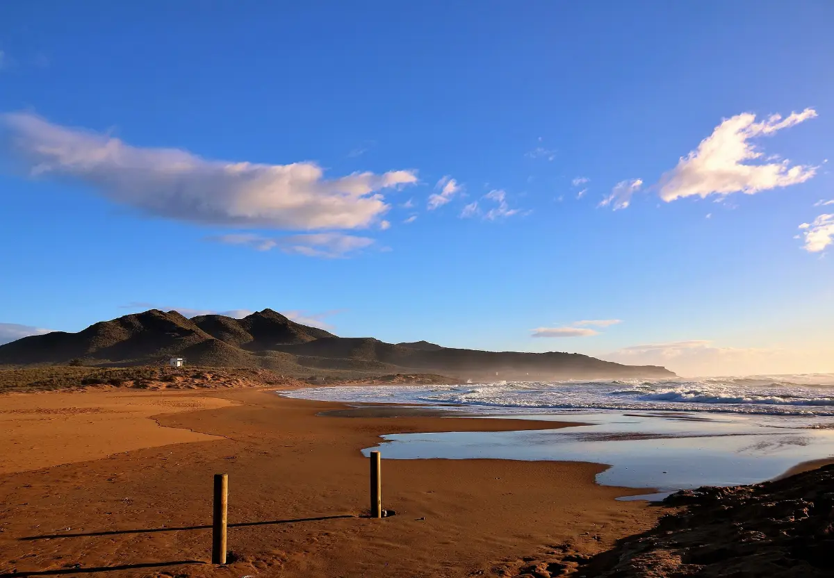
The Region of Murcia’s 2026 order for the Calblanque, Monte de las Cenizas and Peña del Águila regional park bans motor vehicles from the beach area from 20:30 to 08:00 all year. On 27 and 28 June and from 4 July to 30 August, vehicles may not enter the beach area from 08:00 to 20:30 either, except for access to the El Atochar car park between 08:00 and 09:00; a paid bus runs from Los Belones. On 56 other days between April and October, access is limited to 291 vehicles. Overnight camping (bivouacking) on the park’s beaches is not allowed from 1 June to 30 September [3].
On the AlpRoute map you can see campsites and motorhome stops along this coast, free of charge and without an account. Set your vehicle profile with height, width and weight. Before you stay overnight, check that the stop is an authorised overnight area.
Open the Murcia coast route in AlpRoute
The map opens directly on the route. Planning your own multi-stop tour with GPX export is part of AlpRoute Pro, a paid subscription.
AlpRoute does not show live opening times, free spaces or road conditions. Rules in the regional park are set by the Region of Murcia, and local parking rules by each town council. Check them before you set off.
We found no regional list of authorised motorhome areas for this coast in the official sources we checked. The Region of Murcia’s campsite guide lists Camping Bellavista in Águilas, Camping Las Torres near Puerto de Mazarrón and Camping Caravaning La Manga near Cabo de Palos as open all year. Contact each campsite before you go.
Not at night: motor vehicles are banned from the beach area from 20:30 to 08:00 all year. In summer (27 and 28 June and 4 July to 30 August in 2026), the beach area is closed to vehicles during the day too, and a paid bus runs from Los Belones. On 56 other days between April and October, access is limited to 291 vehicles.
Royal Decree 518/2026, published in the BOE on 26 June 2026, added a new paragraph to Article 92 of the General Traffic Regulations. A parked motorhome must not have anything sticking out beyond its outline, must rest only on its wheels (chocks or wedges are allowed) and must not release fluids from the living area. Town councils still regulate parking on urban roads through their own bylaws.
Based on OpenStreetMap data, we calculate about 134 km by road from Águilas to Cabo de Palos, including the side trips to Cabo Cope, Puntas de Calnegre and Bolnuevo, or about three hours of driving without stops. With visits, we suggest three days.
Yes. Our Almería coast route ends at Vera, about 30 km south-west of Águilas, where this route starts. With the 30 km drive from Vera to Águilas, they link the coast from Cabo de Gata to Cabo de Palos.
No. AlpRoute does not show live opening times, free spaces or road conditions. You can see campsites and motorhome stops on the AlpRoute map; check opening times and rules with each place before you go.
Photos from Wikimedia Commons under Creative Commons licences; author, source and licence are named under each photo. The photos were resized and converted to WebP; no other changes were made. The resized versions of CC BY-SA photos are shared under the same licence.
Also available in: Deutsch · Français · Italiano · Español · Türkçe


